Atlas by World Labs


Is this your AI tool? Claim it today.
Verify ownership, manage your profile, and unlock growth features.
Atlas is a cutting-edge omni world model that delivers comprehensive spatial intelligence by integrating diverse spatial data for advanced reasoning and awareness. Ideal for developers and organizations building intelligent, spatially-aware applications, Atlas empowers smarter navigation, planning, and interaction with complex environments.

Description
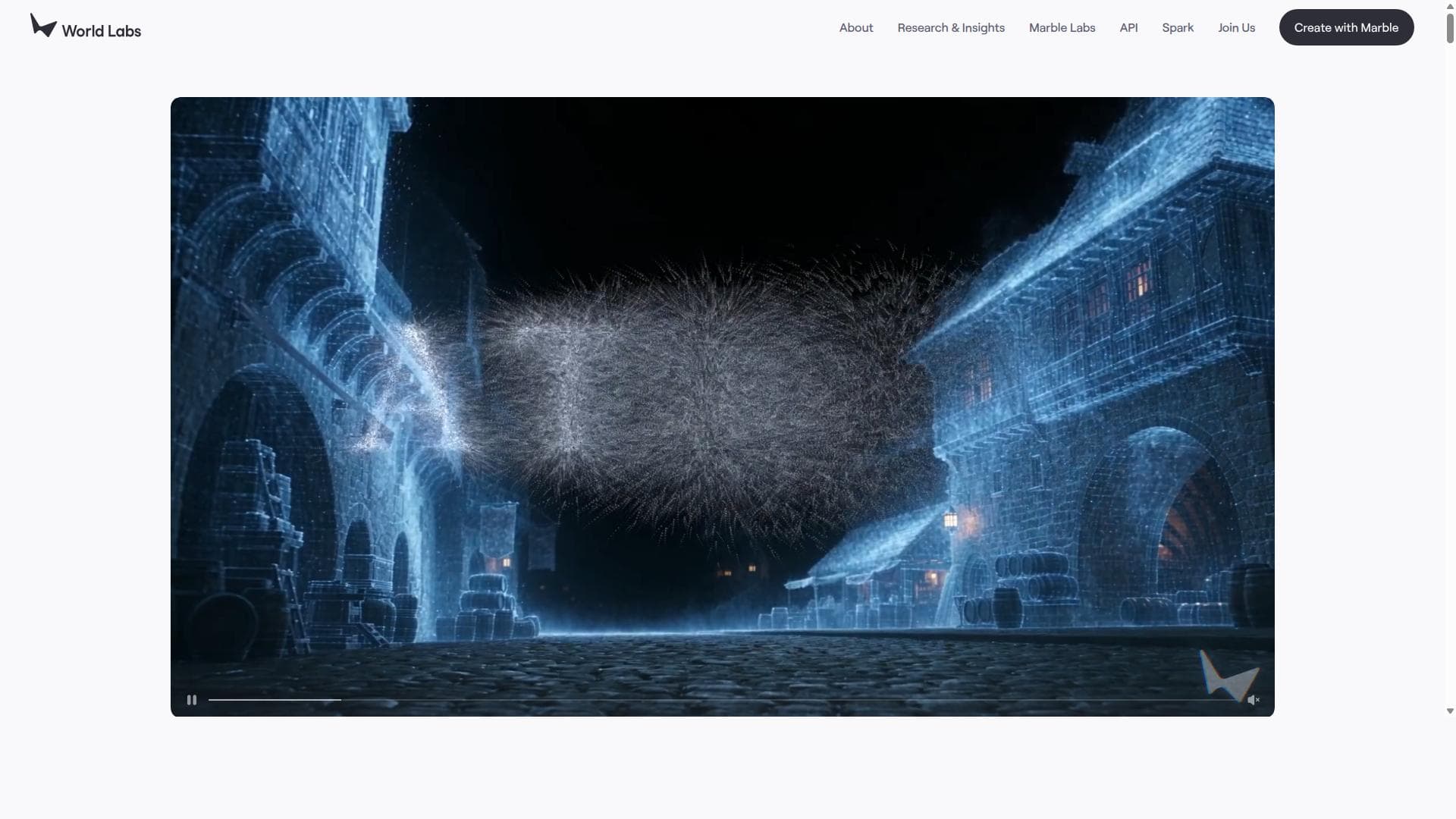
Atlas is World Labs' omni world model. It takes text, images, video, and 3D, then generates camera-controlled 1440p video up to a minute, reconstructs scenes from a few photos, and simulates space-time for robotics. Early access.
Detailed Description
Atlas is an advanced omni world model designed to provide spatial intelligence by integrating and representing comprehensive spatial data. Its core purpose is to enable intelligent applications that require deep spatial awareness and reasoning capabilities. By creating a unified, multi-dimensional understanding of spatial environments, Atlas supports a wide range of use cases where spatial context is critical, such as robotics, autonomous navigation, augmented reality, urban planning, and geospatial analytics. The platform synthesizes diverse spatial datasets into a coherent model, allowing machines and applications to interpret and interact with the physical world more effectively and intuitively. One of the key features of Atlas is its omni world model architecture, which captures spatial information at multiple scales and dimensions. This enables the tool to represent complex environments with high fidelity, including indoor and outdoor spaces, dynamic elements, and temporal changes. Atlas integrates advanced spatial data sources such as 3D maps, sensor data, satellite imagery, and geographic information systems (GIS), providing a rich, layered understanding of the environment. This integration supports sophisticated spatial reasoning, allowing applications to perform tasks like pathfinding, obstacle avoidance, spatial querying, and context-aware decision-making. Atlas is particularly well-suited for developers and organizations working on intelligent systems that depend on spatial context. Robotics companies can leverage Atlas to improve autonomous navigation and environment interaction. Urban planners and geospatial analysts benefit from its ability to model and analyze spatial relationships and changes over time. Augmented reality developers can use Atlas to anchor virtual content accurately within real-world environments. Additionally, industries such as logistics, transportation, and smart cities can harness Atlas to optimize operations through enhanced spatial intelligence. Regarding pricing and plans, Atlas is offered through World Labs, and while specific pricing details are not publicly disclosed on the main website, interested users are encouraged to contact the provider directly for tailored plans based on usage requirements and integration needs. This approach suggests a flexible pricing model that can accommodate various scales, from startups to enterprise-level deployments. When compared to alternatives, Atlas stands out due to its omni world model approach, which provides a more holistic and integrated spatial representation than many traditional GIS or mapping solutions. Unlike tools that focus solely on 2D maps or isolated spatial datasets, Atlas combines multiple data types and dimensions to deliver richer spatial intelligence. This makes it particularly powerful for applications requiring real-time spatial reasoning and dynamic environment understanding. However, as a specialized spatial intelligence platform, it may require a steeper learning curve and integration effort compared to simpler mapping APIs or visualization tools. Notable limitations or considerations include the potential complexity involved in integrating Atlas with existing systems, especially for organizations without prior experience in spatial data modeling. The need for high-quality, diverse spatial data inputs may also pose challenges depending on the use case and geographic region. Additionally, since pricing details are not openly published, prospective users should prepare for a consultation process to understand costs and deployment options. Despite these considerations, Atlas offers a cutting-edge solution for anyone needing advanced spatial intelligence beyond conventional mapping technologies.
Tool Features
- Omni world model for spatial intelligence
- Advanced spatial data integration
- Supports spatial awareness and reasoning
- Enables intelligent applications with spatial context
Description
Atlas is a cutting-edge omni world model that delivers comprehensive spatial intelligence by integrating diverse spatial data for advanced reasoning and awareness. Ideal for developers and organizations building intelligent, spatially-aware applications, Atlas empowers smarter navigation, planning, and interaction with complex environments.
Atlas is World Labs' omni world model. It takes text, images, video, and 3D, then generates camera-controlled 1440p video up to a minute, reconstructs scenes from a few photos, and simulates space-time for robotics. Early access.
Detailed Description
Atlas is an advanced omni world model designed to provide spatial intelligence by integrating and representing comprehensive spatial data. Its core purpose is to enable intelligent applications that require deep spatial awareness and reasoning capabilities. By creating a unified, multi-dimensional understanding of spatial environments, Atlas supports a wide range of use cases where spatial context is critical, such as robotics, autonomous navigation, augmented reality, urban planning, and geospatial analytics. The platform synthesizes diverse spatial datasets into a coherent model, allowing machines and applications to interpret and interact with the physical world more effectively and intuitively. One of the key features of Atlas is its omni world model architecture, which captures spatial information at multiple scales and dimensions. This enables the tool to represent complex environments with high fidelity, including indoor and outdoor spaces, dynamic elements, and temporal changes. Atlas integrates advanced spatial data sources such as 3D maps, sensor data, satellite imagery, and geographic information systems (GIS), providing a rich, layered understanding of the environment. This integration supports sophisticated spatial reasoning, allowing applications to perform tasks like pathfinding, obstacle avoidance, spatial querying, and context-aware decision-making. Atlas is particularly well-suited for developers and organizations working on intelligent systems that depend on spatial context. Robotics companies can leverage Atlas to improve autonomous navigation and environment interaction. Urban planners and geospatial analysts benefit from its ability to model and analyze spatial relationships and changes over time. Augmented reality developers can use Atlas to anchor virtual content accurately within real-world environments. Additionally, industries such as logistics, transportation, and smart cities can harness Atlas to optimize operations through enhanced spatial intelligence. Regarding pricing and plans, Atlas is offered through World Labs, and while specific pricing details are not publicly disclosed on the main website, interested users are encouraged to contact the provider directly for tailored plans based on usage requirements and integration needs. This approach suggests a flexible pricing model that can accommodate various scales, from startups to enterprise-level deployments. When compared to alternatives, Atlas stands out due to its omni world model approach, which provides a more holistic and integrated spatial representation than many traditional GIS or mapping solutions. Unlike tools that focus solely on 2D maps or isolated spatial datasets, Atlas combines multiple data types and dimensions to deliver richer spatial intelligence. This makes it particularly powerful for applications requiring real-time spatial reasoning and dynamic environment understanding. However, as a specialized spatial intelligence platform, it may require a steeper learning curve and integration effort compared to simpler mapping APIs or visualization tools. Notable limitations or considerations include the potential complexity involved in integrating Atlas with existing systems, especially for organizations without prior experience in spatial data modeling. The need for high-quality, diverse spatial data inputs may also pose challenges depending on the use case and geographic region. Additionally, since pricing details are not openly published, prospective users should prepare for a consultation process to understand costs and deployment options. Despite these considerations, Atlas offers a cutting-edge solution for anyone needing advanced spatial intelligence beyond conventional mapping technologies.
Frequently Asked Questions
What is Atlas?
Atlas is an omni world model designed to provide advanced spatial intelligence by integrating comprehensive spatial data to enable intelligent applications with spatial awareness and reasoning capabilities.
How much does Atlas cost?
Atlas pricing is not publicly listed and typically depends on the specific needs and scale of the deployment. Interested users should contact World Labs directly to receive customized pricing and plan options.
Who is Atlas best for?
Atlas is best suited for developers, robotics companies, urban planners, augmented reality developers, and organizations in logistics, transportation, and smart city sectors that require advanced spatial context and reasoning in their applications.
What are the main features of Atlas?
Key features include an omni world model architecture for multi-dimensional spatial representation, integration of diverse spatial data sources like 3D maps and GIS, support for spatial awareness and reasoning, and enabling intelligent applications that interact effectively with spatial environments.
Does Atlas offer a free trial?
There is no publicly available information about a free trial for Atlas. Prospective users should reach out to World Labs to inquire about trial options or demos.
What integrations does Atlas support?
Atlas integrates advanced spatial data sources such as 3D mapping, sensor inputs, satellite imagery, and geographic information systems (GIS), allowing it to work with a wide range of spatial datasets and intelligent application frameworks.
How does Atlas work?
Atlas works by synthesizing multiple spatial data types into a unified omni world model, enabling applications to perform spatial reasoning, awareness, and context-driven decision-making by understanding environments in multiple dimensions and scales.
Reviews
No reviews yet. Be the first to share your experience.